Sunday, July 28, 2013

July 22 - 28

7/22/2013
Mon-AM: 2:33, 5200' ~ Longs Peak
Up the Loft/Beaver/Notch/Stepladder, down Cables. After yesterday's scoping of the downclimb into the Notch with Joel I decided to do the full Skyline Traverse from the Loft and give it a shot. Headed up the ridge from the Loft to the summit of the Beaver is just simple Class 2+ to Class 3 boulder scrambling, but then you get to the summit and the Notch's abrupt and breathtaking abyss. From there, I headed down to the left searching out the descent chimney--it was easy and obvious. After a relatively low-angle 4th Class-ish chimney, the descent eventually cliffs out and there seem to be many options for getting down into the base of the couloir. However, the best looking to me was a traverse to descender's right across a steep, exposed face, but with really solid holds. I think this is the so-called "Gorrell's Traverse". It went fine, and then it was just the Stepladder to summit ridge. Really fun route.

7/23/2013
Tue-AM: 2:38, 5000' ~ Longs Peak
Up Kieners, down Cables. Took it easy today but was still moving well on the mountain. Made the summit at 1:46 (traversing around the top of the Lambs Slide ice to get to Broadway takes an extra 10min more than if I could just kick across the couloir) and then after downclimbing the Cables just cruised easily back down the hill.

7/24/2013
Wed-AM: 2:43, 5000' ~ Longs Peak
Up the Notch Couloir, down Cables. Yesterday I considered climbing the Notch Couloir instead of Kieners, just for a change of scenery, so today I did. While this is typically a snow climb (and would be better as such), it was a fun scramble, too, if a bit loose/gravelly in spots. Once I got to the actual Notch I just took the usual Stepladder finish to the summit. I was a on a hot base to the base of the Notch on Broadway, but then going up the couloir took longer than Kieners normally would. 21st summit of Longs for the year.

7/25/2013
Thu-AM: 1:10, 3000' ~ First Flatiron+Green Mt.
Biked to Chat, cruised a mellow 12:45 scramble on the way to the summit, and ran back down via the front. Cool, humid/drizzly morning, but the rock was dry.

7/26/2013
Fri-AM: 1:02, 1000' ~ Skyline Drive Manti-La Sal Nat'l Forest
Drove to within 90min or so of Salt Lake City yesterday, and then slept in a surprisingly nice spot next to a stream just off the highway. This was an easy out-n-back shake-out jog up a dirt road with a gradual climb on the way out.

7/27/2013
Sat-AM: 5:09, 11,000' ~ Speedgoat 50K
Solid day overall, 2nd place. Didn't quite have enough race course left at the end to catch up to Sage, but was generally happy with my race-day execution and effort. No real low patches (a little bit from mile 15-21), and I thought I closed the last 10mi pretty strongly.

7/28/2013
Sun-AM: 2:41, 5800' ~ Teewinot
Up and down the east face, from Lupine Meadows. Teewinot is the furthest north peak in the Grand Teton massif and the climber's access route provides a very direct grunt to the summit, capped with over 1500' of 4th Class scrambling at the end. I went mellow today, mostly to just get out and get the legs moving. A few hundred feet below the summit I was trending way too far left, but didn't realize my mistake until I ran out of mountain. Ended up having to downclimb ~300' or so to get back on track, but all in all an awesome outing to a super proud summit.

Hours: 18h06min
Vert: 36,000'

Quality week. Lots of fun on Longs Peak earlier in the week, a solid race, and a new Teton summit for me. I should have a report on Speedgoat later in the week.

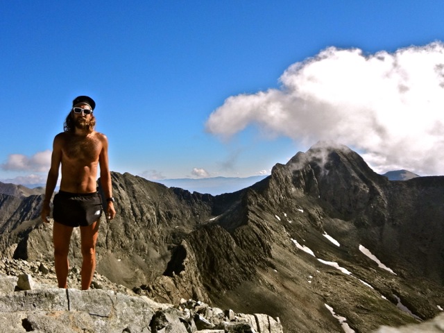
East face of Teewinot. An inspiring, in-your-face route from the parking lot.
Electric guitar, epic horns, and doo-wopping lady-hipsters. Hard to beat.

Monday, July 22, 2013

July 15 - 21

7/15/2013
Mon-AM: 7:58, 12,000' ~ Chicago Basin 14ers (Eolus, N. Eolus, Sunlight, Windom)
Started from the Purgatory TH. Animas River bridge - :37; Needle Creek bridge - 1:26; New York Creek bridge - 1:47; turn to Twin Lakes - 2:36:30; Eolus summit - 3:45:30; N. Eolus summit - 3:55:30; Twin Lakes - 4:12; Sunlight summit - 4:45; Windom summit - 5:11; turn back on to Needle Creek trail - 5:46; New York Creek bridge - 6:15:30; Needle Creek bridge - 6:28:30; Animas River bridge - 7:14:30; back at trailhead - 7:58:34
It'd been a really stormy few days in the San Juans, but I fortunately awoke to clear skies. After waiting for it to get light enough to run sans headlamp, I took off down the Purgatory trail toward the Animas. This trail descends ~1000' down to the river, but rolls up and down along the way, so it takes a minute. The next 50min of running were flat and quick along perfect, groomed path until I crossed Needle Creek and started heading up that drainage into the Chicago Basin. It was surprisingly wet back in there--moss dripping off of trees, humidity in the air--and the creek itself was exceptionally scenic with lots of water flowing over slabs and down drops. Finally turned on to the trail up to Twin Lakes and decided that I would take the southeast ridge up to the summit of Eolus to make a cleaner loop of the 14ers. Roach calls the south ridge "Discovery Ridge", and it is good fun with lots of 4th Class scrambling, maybe a few 5th-Class moves if you don't take the time for judicious route-finding, and a couple of significant notches that were a little tricky. Tagged the summit under sunny skies (but with clouds building) and scurried down and over the famed Catwalk to the summit of N. Eolus. I took a direct descent off this down into a steep scree couloir that deposited me right at Twin Lakes and then it was lots of slab scrambling to get up to the summit of Sunlight. Dark clouds were building and moving in at that point, so I didn't linger long there before heading over to Windom. I took the most direct line possible up Windom's jumbly northwest face and was slightly relieved when I'd hit the summit and begun descending back to treeline. The clouds never rumbled or really threatened, but after the long run back down to the Animas the skies eventually started rumbling and the final 20min or so of slogging back up to the Purgatory TH I enjoyed a welcome, cooling drizzle. I pushed this last climb hard to sneak in under 8hr, so I was happy it wasn't any hotter than it was. Apparently this whole outing is ~42mi and about 30-32 of that are 100% trail running, so it was nice to get that kind of effort in the legs.

7/16/2013
Tue-AM: 2:05, 3700' ~ Mt. Sneffels
Started from the Imogene Pass Rd turn-off on Camp Bird to make it a little longer run. Up the SW ridge and down the south slopes. It was a really foggy/cloudy/cool morning, so there were no views from the summit and the rocks on the 3rd Class ridge were quite slick. On the descent I was taking a narrow/steep side-couloir to access the standard descent couloir when a microwave-sized block came tumbling down from above. The gully was quite narrow, so I had nowhere to go and just hugged the wall as closely as I could with my hands covering my head. Luckily, it exploded on a small ledge just above me and my neck/shoulder was hit by only a softball-sized rock along with a bunch of smaller stuff. Afterward (and days later) my shoulder was super sore, but the whole thing could've been a lot worse.

7/17/2013
Wed-AM: 4:44, 7500' ~ Little Bear-Blanca-Ellingwood Pt Traverse
Parked the Roost at ~8000' on the Lake Como Rd (~2mi in from the paved road) and ran from there. The run up the 4wd road was pleasant and I reached the east end of Lake Como (where the stream comes in) at 1:14. Continued on up the road and decided on-the-fly that the NW Face of Little Bear looked more appealing/direct than the standard Hourglass route. Crossed the stream higher up at 1:22 and reached the "black hand" at the base of the NW Face route in 1:35. The crux of the whole thing was definitely surmounting the headwall right at the base. The line I picked was probably no more than 4th Class but it was very exposed---there would certainly be a lot more of that later on! After the initial bits of 4th Class the route moved back left into the broad/shallow gully and eased to 3rd Class before kicking back up to 4th Class before gaining the ridge and hitting the summit of Little Bear (2:06). Now for the mile-long low-5th Class traverse over to Blanca. This ridge is super aesthetic and classic and I was excited to get to it. Some 4th Class slabs led down to what I felt was essentially the crux of the route--traversing around Capt Bivwacko tower. I knew to go on the left side of it but was a little shocked at just how narrow, steep, and exposed the ledge was. It made Broadway on Longs look like the comfy superhighway it is. Hands were mandatory on this traverse and I was uncharacteristically gripped. Somewhat surprisingly, the whole first half of the traverse pretty much lived up to the hype with innumerable knife edges (all way more airy than Capitol's much-vaunted Knife Edge) and a couple more hyper-exposed north/west side traverses. It all required way more focus and attention than I had expected. I didn't feel like I was moving very quickly or smoothly, and definitely wasn't getting into the nice flow that I usually enjoy about scrambling. Eventually, though, the large gendarmes on the second half of the ridge showed up and I reached the short talus/scree traverse at 2:46. After this, things seemed considerably more moderate (or at least less exposed) and I moved a lot more efficiently, soon reaching the summit of Blanca at 3:03. Some wispy, swirly clouds had moved in and with the abundant and brilliant sunshine the whole scene was pretty magical. The rest of the day was much less gripping with a fun traverse over to Ellingwood Pt (3:23) and then a descent of its SW ridge (more Class 3) before dropping down a talus chute to the extremely well-maintained trail down in the lake basin. I reached the end of the 4wd road at 3:53, was back at the east end of Lake Como at 3:59, and then it was just a casual run down Como Rd back to the Roost. Awesome morning.

7/18/2013
Thu-AM: 3:21, 6000' ~ Harvard & Columbia (Rabbit Ridge traverse)
Started from the N. Cottonwood TH and had a lot of fun on the long running approach up the Horn Fork Basin. Unlike last summer, I feel like I've been able to get in some longer runs with a lot of true running this year, which is nice. Hit the summit of Harvard at 1:34 and noticed that there were actually already a few clouds building, in the east, oddly enough. I felt on-point for the ridge and it felt like it went quite quickly. I did some investigating around the short 5.7 downclimb notch, but I think the beta I gathered the first time is still the best and it actually goes quite easily. On the second half of the ridge I started bonking really hard, so the hump up to Columbia was a bit of a slog, but I made the traverse in :58, hitting the summit at 2:32. The summit was crazy crowded and clouds were moving in quick so I hustled down Columbia's south ridge, taking the most direct line I could. I spent some time frustratingly 'shwhacking around through young aspens in an avy gulch, but still made the Cottonwood Creek bridge in :37 from Columbia's summit and then just cruised the trail back out to the cars, under increasingly dark/thunderous skies. Glad I was off the peaks/ridge when I was.

7/19/2013
Fri-AM: 2:17, 4000' ~ Flatiron Quartet (1-2-4-5)
Ran from Chat w/ Joel, going 1st, 2nd, 5th, 4th before descending back to Chautauqua. I would've liked to have scurried to the summit of Green, too, but didn't have the time. Super hot morning on the slabs, but, thankfully, some clouds and a cool breeze rolled in toward the end making things tolerable.

7/20/2013
Sat-AM: 2:33, 5200' ~ Longs Peak
Up Kieners, down Cables. Within about a minute or two of the trailhead, my legs felt great and I charged up to Chasm Lake having one of those lovely days where the footing is spot on and nearly any grade seems runnable. However, once I started scrambling up the Glacier Rib, it became obvious that all the hot weather in the past month had shrunk Lambs Slide to a chunk of hard, blue ice and I had definitely missed the "tent peg" window on Kieners for the year. Ah, so it goes. I still got to the Broadway level on PR pace for me, but had to spend an extra 10min climbing up a couple hundred extra feet, traversing across the couloir, and then downclimbing back to Broadway before I could continue on my usual path. Broadway itself was in exceptional shape--dry with only a couple convenient rivulets of water and absolutely bursting with wildflowers. What a place. The scrambling up Kieners went smoothly and was only occasionally damp. I emerged onto the summit to find a veritable mob up there enjoying the perfect day, so only lingered long enough to tally my 17th signature in the summit log before scampering down to the Cables. They turned out to be wet but not icy, so the downclimb was simple, and then it was a fun run back down to the trailhead. I decided to dial in the descending skills heading through Jim's Grove and had a blast plummeting through the forest to finish off the day feeling great and with a descent just under 48min. These are the days I live for.
PM: 1:08, 3000' ~ 1st Flatiron+Green Mt.
Did the customary evening lap. There was a whole bunch of people on the summit of the First, so I didn't even pause and just moved right into the downclimb before heading to the top of the hill. Hot and humid (compared to the high country).

7/21/2013
Sun-AM: 2:53, 5000' ~ Longs Peak
Up Loft/Clark's Arrow/Notch/Stepladder, down Cables. Ran easy with Joel. Clark's Arrow is always a little frustrating because you drop a couple hundred feet from the Loft to get into Keplinger's Couloir, but I think we scoped out Gorrell's Traverse (the downclimb into the Notch from the summit of the Beaver), so I'll try that tomorrow and get the full Skyline Traverse. The Stepladder was a really fun pitch up to the skyline finish leading to the summit; wish it was longer. On the way down, the Cables downclimb seemed to be even more dry than yesterday, and then we just cruised mellow back down to the trailhead.

Hours: 27h04min
Vert: 46,400'

Really fun week. Ticked a couple significant summer objectives, especially the Chicago Basin 14ers and the Little Bear-Blanca Traverse.

Heading up to the summit of Eolus via the south ridge. The Catwalk leads to N. Eolus in the distance.
Summit of Eolus.
Looking back to my orange descent couloir (and N. Eolus) from Twin Lakes. 
Sunglight, Sunlight Spire, and Windom as seen from Eolus.
Jagged Mt and the Grenadiers from the summit of Sunlight.
Eolus and N. Eolus (and Pigeon and Turret) as seen from Sunlight.
Base of Little Bear's NW Face. The route goes up the talus slope and engages the rock just right of the "black hand". 
Summit of Little Bear with the mile-long connecting ridge leading to Blanca behind me. 
Looking back to Little Bear from the summit of Blanca.
The traverse to Ellingwood Pt as seen from Blanca.
Blanca and Little Bear from Ellingwood Pt.
Rabbit Ridge---the connecting traverse from Mt. Harvard to Columbia.
Looking back at the crux downclimb crack halfway across Rabbit Ridge.
Wildflowers on Broadway.
The direct line through the Loft headwall. Photo: George Barnes.
Joel downclimbing the Cables on Longs' North Face.

Tuesday, July 16, 2013

July 8 - 14

7/8/2013
Mon-AM: 1:48, 3500' ~ Mt. Sneffels
Up the SW ridge and down the standard south slopes route, from a little bit below the Governor Basin aid station location on Camp Bird road.

7/9/2013
Tue-AM: 7:38, 12,000' ~ Hardrock Course - Grouse Gulch to Silverton clockwise
Handies summit - 1:16; Burrows - 1:51:30; Sherman - 2:21:30; Pole Creek - 3:53; Maggies - 4:44:30; Stony Pass - 5:18; Cunningham - 5:55; Little Giant summit - 6:43.
Started at Grouse Gulch (mile 58) and ran the 42mi back to Silverton. Kept a steady pace all day and was able to feel really strong and push quite hard on the final 2700' climb up Little Giant. The course is surprisingly rolling/runnable from the top of Cataract Gulch (out of Sherman) through Pole Creek and over to Maggies. The final mining road descent down Arastra Gulch was a bit of a bummer, though, and seemed to drag on forever.

7/10/2013
Wed-AM: 2:44, 5000' ~ Vermilion Peak (13,894') & Golden Horn (13,780')
I knew I wanted to run up and scramble something in the Ice Lakes Basin, but I didn't decide on these two striking peaks until I got up there. The ridge descending from Vermilion to the north seemed to cliff out so I ended up going down a nasty scree chute before climbing Golden Horn. Really fun run even if my legs were tired. Wished I had the energy to do the full ridge scramble over to Grant-Swamp Pass.

7/11/2013
Thu-AM: 4:19, 8500' ~ Ice Lakes Basin Traverse - US Grant Peak (13,767'), V4 (13,502'), Pilot Knob (13,738'), Golden Horn (13,780'), Vermilion Peak (13,894'), Fuller Peak (13,761')
From the South Mineral Creek TH. Grant-Swamp Pass, 0:54; US Grant Peak, 1:13:30; V4, 1:33; Pilot Knob, 2:27; Golden Horn, 2:52; Vermillion Peak, 3:15:30; Fuller Peak, 3:27; Ice Lake, 3:51.
Really fun morning in the mountains. After yesterday's run I was thinking it would be nice to do the full traverse of these high-13ers, but I wasn't planning on that this morning. However, once I got up in the high basin it was pretty tough to not be inspired, so I just went for it. Grant wasn't too bad--maybe one short section of 4th Class--but then there was some delicate 5th Class choss negotiation going on to get to the summit of V4. Definitely the most technical bit of the whole traverse and not something that I would've enjoyed downclimbing. From there it was a long traverse on heinous scree/talus slopes to get to the climb up to Pilot Knob. Again, some mellow 4th Class stuff to tag that one and then a pretty straightforward ascent up Golden Horn. From Golden Horn I wanted to take the ridge up to Vermilion instead of the nasty scree chute I descended yesterday and it actually worked out quite well. I was able to find a reasonable enough weakness in the cliff band that turned me around yesterday and I was soon on top. From Vermilion it's easy talus over to Fuller and then some pretty crazy scree/talus surfing to get back down into the basin. Awesome day, but a gel and a little water would've made the second half a little more enjoyable.

7/12/2013
Fri- off, crewing for Joe at the Hardrock 100. Unfortunately, we didn't get to do the planned long march through the night.

7/13/2013
Sat-AM: 1:55, 4500' ~ Handies Peak
After sleeping in, went up and down the mountain from Grouse Gulch. Pushed the uphill pretty hard to tag a 1:06 ascent and then jogged the downhill. Lots of monsoony swirling clouds and sprinkles.

7/14/2013
Sun-AM: 2:18, 4500' ~ US Grant Peak & V4
From South Mineral Creek TH. One last run up in one of the most beautiful basins in the state. After running up to Grant-Swamp Pass I scrambled over the two mountains and then took the Kamm Traverse for a little longer descent back to the car.

Hours: 21h04min
Vert: 38,000'

A great week down in the San Juans. There is a ton of super high quality stuff down here, but a lot of it requires long running approaches, which is fine. I've gotten to do a lot---notably the Grenadier traverse, the Chicago Basin 14ers, and the Ice Lakes Basin traverse---but I'm excited to head back north and get out of this perpetually rainy/damp monsoon weather cycle.

This Friday and Saturday are the Boulder premieres of Joel Wolpert's new film In The High Country, at the Dairy Center. Friday night is sold out, but there are still tickets available for the Saturday screening, which you can purchase here. I, of course, will be at both screenings along with Joel himself.


Golden Horn.
Left to right: Fuller Peak, Vermilion Peak, and Golden Horn.
The trail leading up to Grant-Swamp Pass and US Grant Peak.
Island Lake with Fuller Peak, Vermilion Peak, and Golden Horn in the distance.
Standing on the summit of V4, there's still a lot of ridge to go.
Summit of Pilot Knob with Golden Horn, Vermilion and Fuller coming up.
From the summit of Pilot Knob, looking back to V4 and US Grant.
Vermilion and Fuller from the summit of Golden Horn...almost done.
Looking back at the full ridge: Vermilion, Golden Horn, Pilot Knob, V4, US Grant and Grant-Swamp Pass on the extreme right.

Monday, July 8, 2013

July 1 - 7

7/1/2013
Mon-AM: 3:15, 5300' ~ Maroon Bells Traverse
From Maroon Lake, up South Maroon and down North Maroon, 3:15:37 car-to-car. Splits: Crater Lake, 17:10; S. Maroon turn-off, 36:10; ridge, 1:22:55; S. Maroon, 1:51; Saddle, 1:57:30; N. Maroon, 2:16:50; Crater Lake, 3:02. I did this once before last September, but Joel was filming on that run so there was a lot of stop-and-go and I wanted to get a true, no-stops time on the route. The descent off of North Maroon and back to the parking lot could go a lot quicker if your tolerance for kicking rocks down the mountain and elbowing past tourists after Crater Lake is a lot higher than mine. Wasn't in the mood to be an asshole, so just took it pretty casual.

7/2/2013
Tue-AM: 2:42, 4700' ~ Pyramid
From Maroon Lake, up the West Face/NW ridge and down the NE ridge (standard route). 1:47 to the summit, :55 descent. Wanted to scout this ascent for a link-up of the Bells with Pyramid, and it was classic Elk choss. After crossing West Maroon Creek the talus field and grassy rib ascent went well but then I erroneously chose a 5th Class chute instead of staying further left on the bits of grass. After emerging from that it was lots of route-finding and choss-management to finally make the summit.

7/3/2013
Wed-AM: 6:58, 8500 ~ Capitol-Snowmass Link-up
From the Snowmass Ranch TH, ran up West Snowmass Creek, bushwhacked up to Moon Lake, summited Capitol, traversed back over the Knife Edge to drop into Pierre Lakes Basin, cross the Snowmass-Capitol connecting ridge and finally ascend Snowmass' west ridge before dropping down to Snowmass Lake and running the trail back to the trailhead. Really fun day with hours of talus hopping and some good bits of scrambling.

7/4/2013
Thu-AM: 2:44, 4800' ~ Castle & Conundrum
Up Castle's NE ridge from the Ashcroft road, over to Conundrum, and back down. Tired legs from yesterday, but the mellow 4WD road was a nice change after all of yesterday's scrambling. This finished off the Elk 14ers then.

7/5/2013
Fri-AM: 2:23, 4400' ~ Oscars Pass
Up and down Bear Creek/Wasatch Saddle from the Telluride Town Park, with Joe. Since the Hardrock course is going back to its original routing this year, Joe wanted to check out the trail. It's awesome. This is the best course in the world.

7/6/2013
Sat-AM: 7:16, 10,800' ~ Grenadier Traverse (well, Arrow, Wham, & Three Trinities)
From the Molas Lake TH I enchained Arrow Peak, Vestal Peak, and the three Trinities before running back. Splits:
Animas River, :27
Elk Creek Trail beaver pond, 1:05
Vestal Creek crossing, 1:46
base of Arrow, 2:03
summit Arrow, 2:33/34
base of Wham Ridge, 3:04
summit Vestal, 3:39/40
Vestal/W. Trinity Saddle, 4:00
summit W. Trinity, 4:17/18
summit Middle Trinity, 4:44
Middle/E. Trinity Saddle, 4:49
summit E. Trinity, 4:58
Elk Creek crossing, 6:00
Elk Creek Trail (beaver pond), 6:03
Animas River, 6:34:30
Trailhead, 7:16:45
The run in on the Colorado Trail/Elk Creek Trail was on very good tread and the climbers/use trail heading up Vestal Creek was easy to find. It was a bit choppy at first negotiating a fair bit of deadfall but not too bad. The ramp up the northeast face of Arrow is super obvious and most of the way is just marching up a giant slab, turning into some minor 4th-ish class stuff at the top. About half-way up I ran into Timmy Parr, who was climbing with a partner, but I didn't chat long knowing I had a lot of vert/scrambling ahead of me. My only major mistake of the day came in my descent off Arrow. For some reason I thought the gully down its south face would be quicker than retracing my route down the ascent ramp. Oy, bad choice. The top was full of loose debris and then about 2/3rds of the way down, the gully narrowed and cliffed out. I'd already dropped about 6-700', so I was reluctant to head back up over the summit and instead decided to try out the steep, definitely 5th Class downclimb. It's hard to grade something you're on-sight downclimbing, but with the water-slick rock and in running shoes it felt like 5.5-6 for me. Definitely stressful and cruxy. With that behind me, I was good and warmed up for Wham. I suppose if I had only been interested in traversing the peaks I could've just gone up Vestal's SW ridge/face, but Wham Ridge is one of the most classic alpine routes in the state so I was psyched to drop all the way to 12,200' or so to climb its full extent. The bottom half is super mellow, fairly low-angle slab marching, but eventually the grade kicks up a bit and the terrain becomes 4th Class on solid rock. The crux was a maybe 30' crack unavoidably out on the face and massively exposed, but 5.4 sounds about right---holds were there whenever you needed them. Above that was more 4th Class with the odd easy-5th move and soon enough I was on the summit. West Trinity was the least interesting/engaging peak of the day being mostly 3rd Class but then Middle Trinity probably served up the most complexity of the day for me. I stayed right on the ridge crest for too long and eventually dropped to the south and negotiated a Broadway-like ledge that required one spicy bit of downclimbing before lots of 4th Class led to the summit. Fairly certain I did not find the easiest way up this peak. Mercifully, East Trinity was the most straightforward route-finding of the day--straight up a 3rd Class gully with a little 4th Class at the top--and only required an extra 500' or so of vert. The run back out to the car went well enough, but the nearly 2000' climb back up to the car from the Animas River was a kick to the nuts in the hot mid-day sun as I stubbornly refused to pop one final gel. Good practice to run up a climb like that late in an outing, though. Overall, one of the more satisfying runs I've had in the mountains. I suppose some day it would be worthwhile to come back and tack on Silex, Storm King, and The Guardian, but I really enjoyed the aesthetic of this outing.

7/7/2013
Sun-AM: 2:03, 4500' ~ Handies
Up and down from Grouse Gulch. Nice mellow outing on tired legs. The 500' drop into American Basin is always a little less fun (as a climb) on the way back down.

Hours: 27h21min
Vert: 43,000'

A fun week exploring the Elk Range that was punctuated with the particularly satisfying traverse of the Grenadiers, something I've been wanting to do for a long time. This week I'll be pacing Joe at the Hardrock 100 on Friday, with hopefully a couple other San Juan adventures thrown in.

Looking at the traverse over to North Maroon Peak, Monday morning.
Goat on the summit of Pyramid Tue morning with the next day's objectives on the horizon--Snowmass & Capitol.
Vestal and Arrow Peaks as seen from the approach up the Elk Creek drainage Saturday morning.
Arrow Peak's NE face, the morning's first objective.
Vestal Peak's famed Wham Ridge (north face). Can't believe this one came out blurry. Dammit.
Starting up the iconic face.
Approaching the crux on the ridge.
Summit of Vestal, with Arrow behind.
Next up, West Trinity.
Looking back west along the line-up of five peaks, after having summited and mostly descended East Trinity.
Vestal and Arrow Peaks, from the northeast.